CALTECH STUDENT HISTORY NOTES
THROOP PEAK
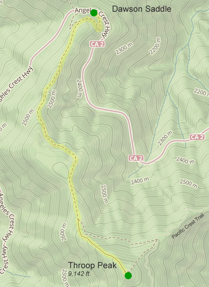
With excerpts from the Sierra Club webpageThroop Peak is a 9,142ft peak in the San Gabriel Mountains located at 34.35056oN 117.79944oW. It lies in the San Gabriel Mountains National Monument and Angeles National Forest, in Los Angeles County, California, and marks the northwestern boundary of the Sheep Mountain Wilderness.. The peak provides views of both the Mojave Desert and the Los Angeles Basin all the way to the ocean. It was named for Amos G. Throop, founder of Caltech, formerly called Throop College. It is most readily ascended from the Angeles Crest Highway at the Dawson Saddle (see map). From there the hike is 4 mi round trip with a gain of 1200ft. Generally considered a moderately challenging hike, it takes an average of 2.5hrto complete.
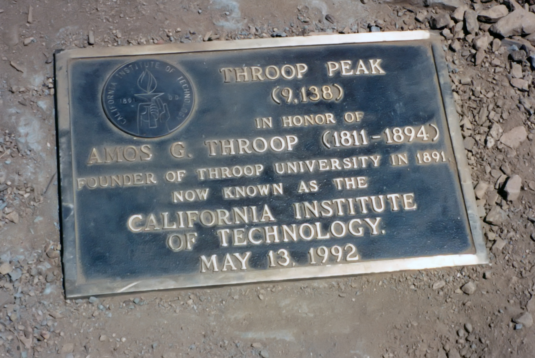
Named for the Throop Polytechnic Institute in Pasadena, founded in 1891 by Amos Gager Throop. Samuel V. Broadwell left a note, signed by himself and three witnesses, in the summit register naming this peak "Mount Throop after my alma mater, Throop, College of Technology" (1916). This was accepted by the USFS and the USGS. The name first appears on USFS Angeles National Forest map in 1925.
However, an earlier name is still remembered by some. This summit and a neighbor had together once been called North Baldy Mountain. This summit was distinguished as the West Twin (C. F. Saunders, 1923). When East Twin was renamed Mount Baden Powell, there was some interest in designating this summit alone as North Baldy Mountain. The USFS thereupon reduced Throop to a subtitle and printed "North Baldy" on its maps (1926-54)--but the name failed to stick. (Robinson notes another variant name no longer used: Mount Dougherty after A. A. "Doc" Dougherty of Coldbrook Camp).
|
|---|
| Map of Throop Peak Hike |
|
|---|
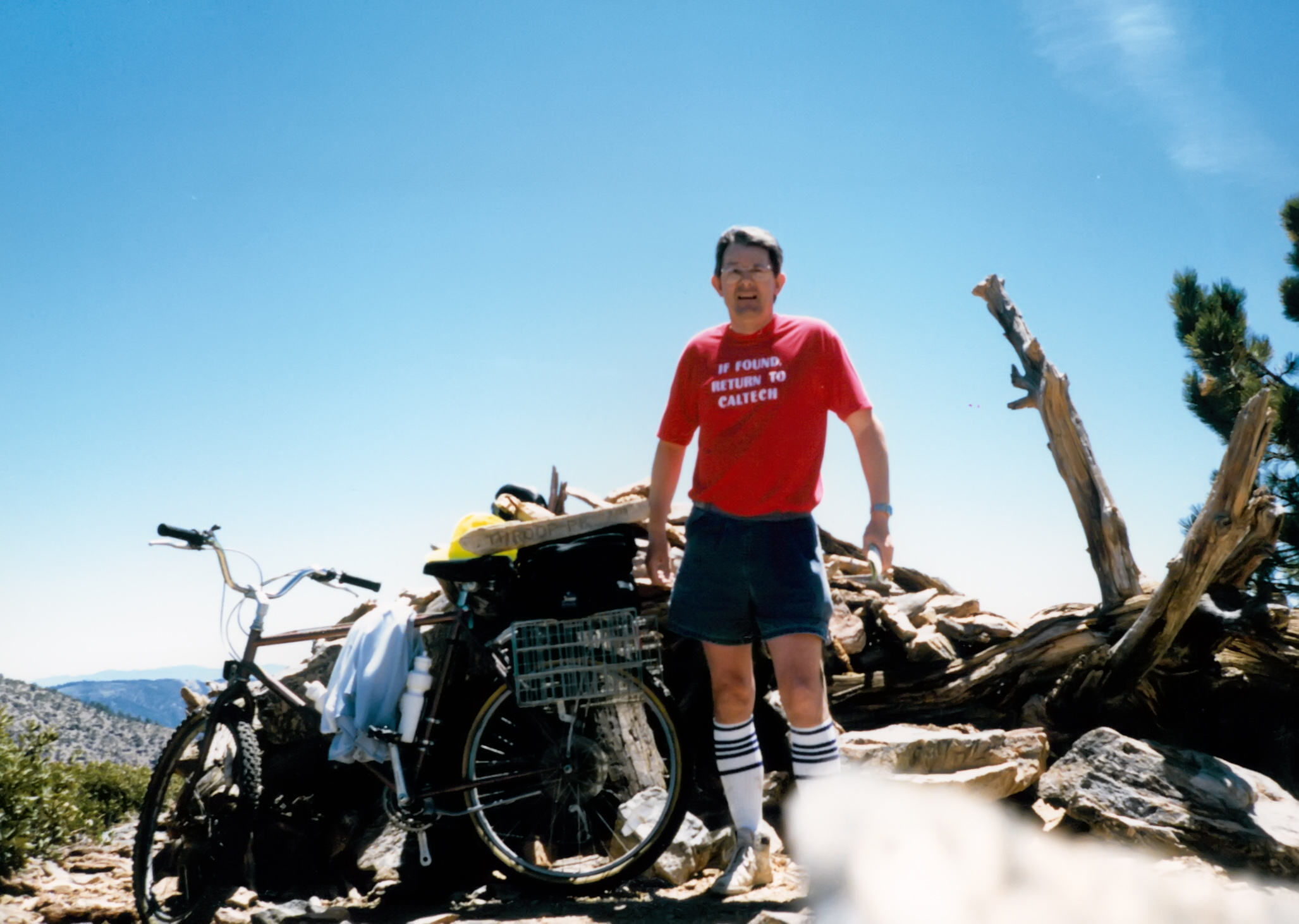
| Author on Throop Peak summit |
|
|---|
| The plaque atop Throop Peak |
Last updated 4/10/04.
Christopher E. Brennen